


Unconfirmed tornadoes, hail, heavy rain, heaving gusts and April snow rocked parts of the South as a spring storm system made its way toward the Northeast on Monday.
More than 40 million people from Texas to New England were under National Weather Service watches, warnings and advisories, mostly related to the storm.
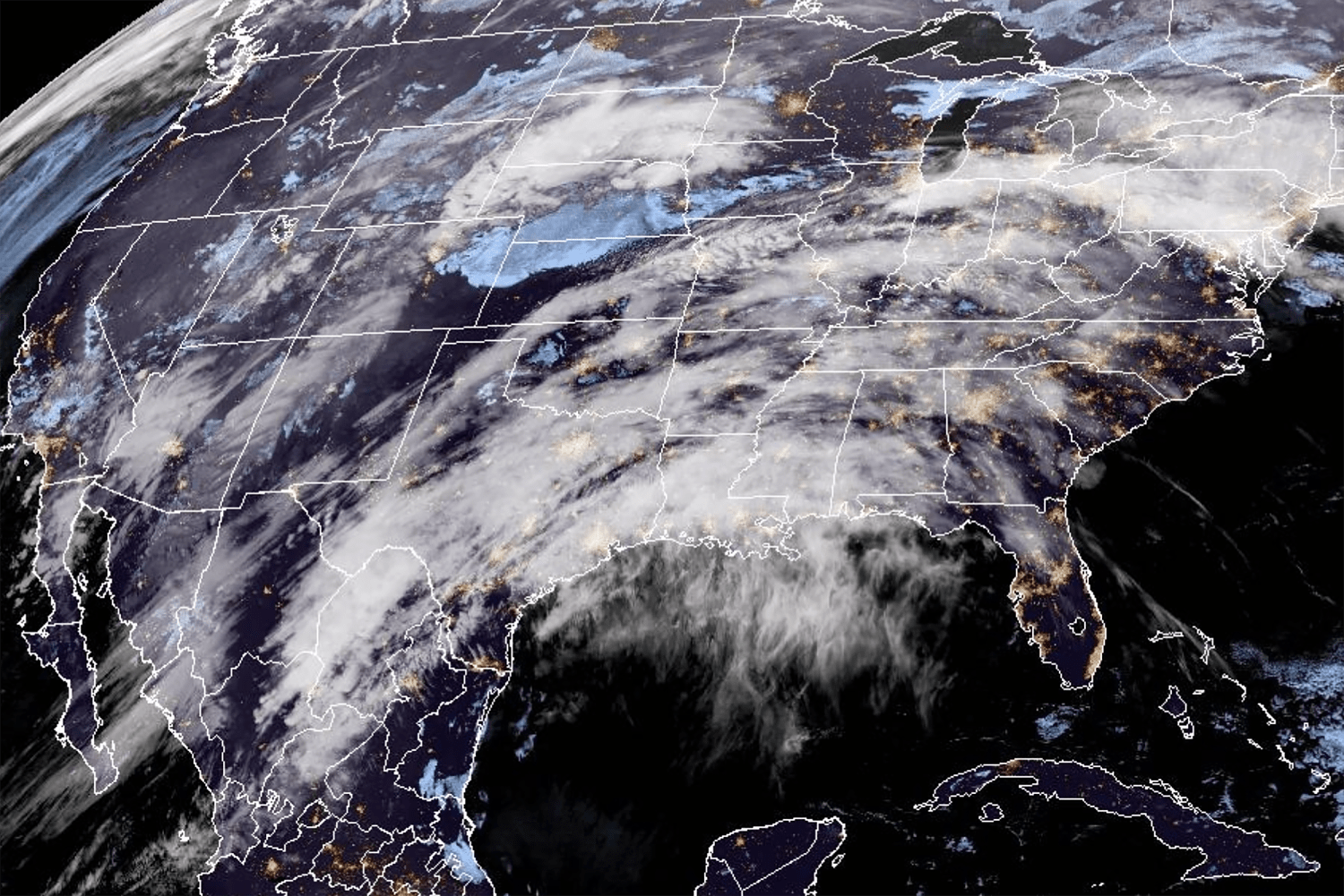
The front was pulling in cold air from the Midwest as it clashed with warm air on its journey toward the East Coast. Along the way it produced a diagonal line of thunderstorms from Texas almost into the Mid-Atlantic, with parts of the Midwest and Southeast treated to unsettled air roiling with hail, gut-punch gusts and spinning vortexes.
In Montgomery County, Kansas, the large hail predicted by the National Weather Service arrived and began to melt into icy balls the size of dim sum dumplings, according to social media imagery verified NBC News.
A funnel cloud was spotted between Kingfisher and Okarche, Oklahoma, on Monday, but it wasn’t clear if it developed into a tornado. NBC affiliate KFOR of Oklahoma City reported that the vortex indeed touched down, though confirmation from the National Weather Service usually requires next-day observation of its path and damage.
Heavy rain fell at times in Indianapolis, Indiana, where federal forecasters warned that large hail, flooding and lightning strikes were possible, if not likely, overnight.
The National Weather Service warned of damaging winds gusting up to 60 mph, EF2 tornadoes and “very large” hail possibly 2 inches in diameter. EF2 tornadoes could bring wind gusts of 111 to 135 mph, according to the weather service. The biggest threat for the strong tornadoes is an area from northeast Oklahoma to central Missouri.
A barrage of vortex weather after dark is a dangerous situation. Studies have found that nighttime tornadoes are twice as deadly as daytime ones. “Be prepared to take action if watches and warnings are issued for your area,” the weather service advised.
The front still had plenty of time to act up, but at least by Monday evening, its impact on electricity grids was relatively minor, with only Texas reporting a significant number of utility customers — nearly 15,000 — without power, according to utility tracker PowerOutage.us.
What to expect
- Monday: Intense storms from Texas to Illinois; heavy rain and flood risk increases in the Ohio River Valley.
- Tuesday: Severe risk shifts east into Tennessee and the Ohio River Valley; heavy downpours could lead to localized flooding.
- Wednesday: Heavy wet snow likely to develop for New England. Upward of 18 inches of snow is possible from the Great Lakes all the way into interior New England and into Maine.
On Tuesday, the risk shifts east into Tennessee and the Ohio River Valley, moving into the mid-Atlantic and Northeast, where rain is expected to last through Wednesday. Eight million people are under flood watches through Tuesday across the Ohio River Valley into the Appalachians, including Cincinnati and Columbus in Ohio and Charleston in West Virginia.
“There is a sight risk of excessive rainfall over parts of the Middle Mississippi and Ohio Valleys on Monday and over Eastern Ohio, Tennessee Valleys and Central Appalachians on Tuesday,” according to the weather service. Localized areas of severe flooding are possible from middle Mississippi to the central Appalachians.
When the storm shifts east Tuesday, rainfall could total up to 3 inches from Kansas City, Missouri, to New England. And parts of the north from the Great Lakes to New England could see up to 18 inches of snow Wednesday.
New York Gov. Kathy Hochul warned residents of the state to prepare for the worst as the front could bring heavy snow, rain and high winds to the North Country, Capital, Central, Mohawk Valley, Southern Tier and upper Mid-Hudson regions.
New York City and Long Island could see as much as 3 inches of rain from the storm Tuesday into Wednesday, her office said in a statement. The highest elevations of the Adirondack and Catskill mountains could see up to 2 feet of snow while the North Country, Capital and upper Mid-Hudson could get “a wintry mix” of slush and snow — all on Wednesday, it said.
Travel will be hazardous and power outages were possible, Hochul’s office said.
The same system brought torrential downpours to California over Easter weekend.
In Santa Barbara County, some drivers were left stranded after severe flooding shut down a highway. Twila Douglas was driving up from Los Angeles when traffic came to a standstill.
“We heard this like raging water sound, and we’re like, this is not good at all,” she said after the experience.
A portion of the state’s scenic Highway 1 collapsed into the ocean during heavy rain, stranding drivers and shuttering a part of the highway near Big Sur.
Around noon Sunday, crews determined that travel in the northbound lane was safe, and authorities began periodically escorting motorists around the damaged section. About 300 cars were waiting to travel northbound when officials led the first convoy through the area, the San Francisco Chronicle reported.
Some stranded motorists had to sleep in their cars while others were sheltered at the nearby Big Sur Lodge, the newspaper said. Two people were hospitalized with unspecified injuries.
Video from San Jose showed lightning striking scarily close to an airplane.
Up north in Truckee, which got 14 inches of snow this weekend, two people were killed in a single-engine plane crash while attempting to land Saturday.
The victims were identified as Liron and Naomi Petrushka by UpWest, a company they invested in that supports Israeli entrepreneurs. Liron Petrushka was a senior adviser at the seed fund, according to the company’s website.
The National Transportation Safety Board is investigating the crash. Truckee is about 100 miles northeast of Sacramento.


