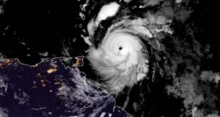
Dangerous severe storms with possible tornadoes swept across parts of the U.S., including in Texas and Oklahoma, on Saturday night.
Federal forecasters issued tornado watches and warnings for parts of Texas, Oklahoma, Arkansas, Missouri and Kansas, with the National Weather Service office for Fort Worth, Texas, urging residents in the path of unstable thunderstorm cells north of Dallas-Fort Worth to “SEEK SHELTER NOW!!!”
The weather service’s office for Tulsa, Oklahoma, said radar had confirmed a tornado in the area of Claremore shortly before 11:24 p.m. It said another tornado appears to have struck near Pilot Point, Texas, about 55 miles north of Dallas, late Saturday.
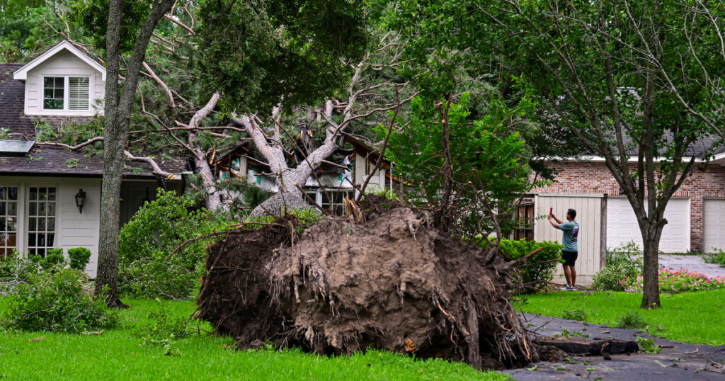
Texas’ Denton County Office of Emergency Management said there had been a confirmed tornado over Lake Ray Roberts State Park, northeast of Sanger.
The City of Denton Fire Department on X posted a photo of a heavily damaged building, saying it was sending medics and rescue crews to help “multiple victims,” including some who were trapped.
Experts say the Plains, and parts of the South and Midwest have been subjected to a long and deadly tornado season during an epic and lasting clash between cold and warm influences.
Chief meteorologist Bill Berardelli of NBC affiliate WFLA in Tampa, Florida, explained the recipe for whipped-up weather in a post on social media platform X:
“Big heat ridge parked over Mexico/Gulf, and cold pool over the Pacific NW [is] a perfect setup as disturbances ride a semi-stalled frontal boundary focusing storms over #Tornado Alley,” he said.
Thunderstorms over Oklahoma and Texas are expected to push east into Missouri and Iowa overnight. A few long-lived supercells are also expected. These storms are capable of producing intense tornadoes, giant hail and destructive wind gusts.
Clusters of these supercells will merge, creating larger storm systems in northern Oklahoma and central and eastern Kansas overnight, the National Weather Service said on X, adding that “some isolated to widely scattered instances of flash flooding” will be possible through midnight.

The storms will continue to push east on Sunday, moving into the Midwest and Ohio Valley. They are expected to affect 42 million people in cities such as Chicago, Indianapolis, Nashville, St. Louis and Cincinnati.
Damaging wind gusts are most expected across the Midwest, but tornadoes and large hail are also possible.
The storms will finish off on the East Coast on Monday, with a slight risk of severe weather issued to the mid-Atlantic. In this region, including Baltimore; Washington, D.C.; and Charlotte and Raleigh, North Carolina, 27 million are at risk of experiencing strong to severe thunderstorms.
The primary hazard to watch out for is severe wind, but a storm or two could be capable of producing large hail or a tornado.

With this active storm pattern comes the risk of flash flooding, especially across the mid-Mississippi Valley. In total, 3 million are under flood alerts including in cities such as Memphis, Tennessee; and Tupelo, Mississippi.
Rainfall totals will generally range from 1-2.5 inches through the weekend, with localized higher amounts of 3-plus inches possible where training storms develop.
Southern heat
The South will also be facing extreme heat over Memorial Day weekend.
Summerlike temperatures will affect the southern Plains and the Gulf Coast as highs soar to 10-20 degrees above average.
Heat alerts are in effect for 7 million across southern Texas on Saturday, including in Austin, San Antonio, Corpus Christi and Brownsville, as temperatures will climb as high as 100-115 degrees.

Nearly two dozen record highs will be threatened Saturday afternoon as temperatures reach into the 90s-100s in Brownsville and Houston, Texas; Key West, Florida; and New Orleans.
Both Brownsville and Harlingen, Texas, set new daily high records Saturday with Brownsville hitting 99 degrees and Harlingen at 100 degrees, according to the NWS, both 2 degrees higher than their previous records.
On Sunday, more heat will cover the South, with more than 20 record highs threatened in Corpus Christi; Miami and Orlando, Florida; Baton Rouge, Louisiana; Dallas, Houston and San Antonio.
Extreme fire conditions
Four million are under alerts for critical fire weather conditions across the high and southern Plains from Colorado to Texas, including Albuquerque and Santa Fe, New Mexico; and El Paso, Texas.
Newly formed fires are at risk of rapidly spreading due to the dangerous combination of dry vegetation, 30-45 mph winds and low relative humidity.